


Preview
Creation Date
2014-03-31
Description
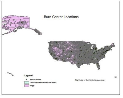
This map shows one hour travel time coverage areas of burn centers in the United States. It was found that 36% of the population has no access to a burn center within a 60 minute drive.
Keywords
GIS, healthcare access, network analysis