


Preview
Creation Date
2015-07-22
Description
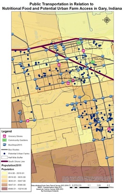
Gary Urban Farms developed a map that is useful to our city in relation to how nutritional food is accessed currently and how they plan to fill in the gaps for accessing nutritional food by mapping out the location of their potential urban farm sites. As a part of our sustainability initiative we have developed a way for residents to find their way to and from current grocery stores and community gardens with the use of public transportation.
Keywords
Food desert