


Preview
Creation Date
2014-04-14
Description
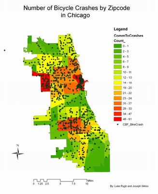
The map above is a choropleth map that shows the total number of accidents in each zip code of Chicago. This map isolates which areas of the city need to address issues surrounding bicycle safety the most. This information helps city officials in creating bicycle policies and other types of policies surrounding traffic safety.
Keywords
GIS, bicycle safety, urban transit