


Preview
Creation Date
2014-04-14
Description
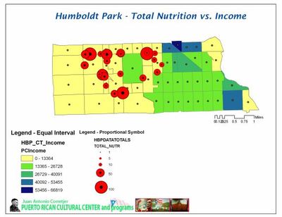
This map compares mean income to mean index level of nutrition in the Chicago Humboldt Park neighborhood. Mean income was calculated using U.S. Census Bureau census tract data from 2000. This map suggests that income is not strongly correlated with the location and quality of grocery stores in Humboldt Park.
Keywords
GIS, Humboldt Park/West Town, food access, economic inequity