


Preview
Creation Date
2014-04-07
Description
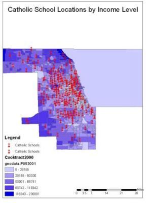
This map displays the locations of all known Catholic Schools as well as Income Levels by Chicago Census Tract. As the Archdiocese continues to lose enrollment in its schools, it is important to identify groups and areas that have higher income levels as a means to pursue a Catholic education.
Keywords
GIS, Catholic Education, Archdiocese of Chicago